
Fact sheet - Environmental Assessments
The role of the Office of Groundwater Impact Assessment and the Independent Expert Scientific Committee on Coal Seam Gas and Large Coal Mining Development in environmental assessments
Purpose
The purpose of this fact sheet is to explain the commonalities and differences in function between the Independent Expert Scientific Committee on Coal Seam Gas and Large Coal Mining Development (IESC) and the Office of Groundwater Impact Assessment (OGIA) and to provide a shared understanding on matters where outputs from OGIA’s assessment are referred to by the proponents in their environmental impact assessments.
Background
The IESC is a statutory Committee, commissioned under the Commonwealth Environment Protection Biodiversity Conservation Act 1999, of leading scientists that independently advise ministers and government regulators on the impacts that coal seam gas and large coal mining development may have on Australia’s water resources.
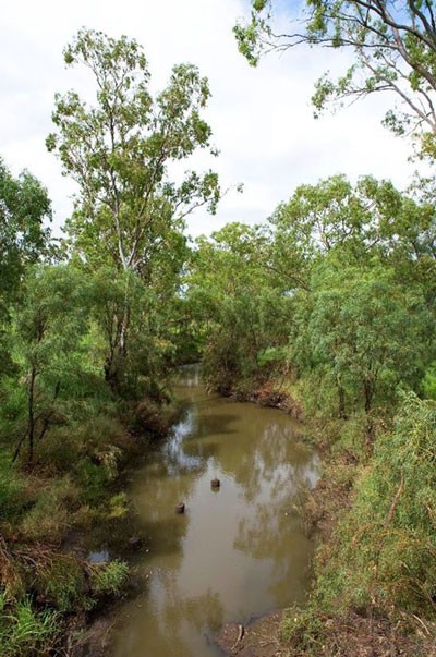
The Condamine River between Dalby and Cecil Plains
The Office of Groundwater Impact Assessment (OGIA) is an independent statutory entity established under Queensland legislation for the assessment and management of groundwater impacts from the extraction of groundwater by resource tenure holders (petroleum, gas and mining). OGIA is responsible for undertaking cumulative impact assessments and setting out management arrangements in areas where impacts from multiple tenure holders may overlap. Such areas are declared as ‘cumulative management areas’ (CMA). Currently there is one CMA in Queensland that was established in 2011 covering the Surat and Southern Bowen basins in response to coal seam gas (CSG) development (the Surat CMA). Petroleum and gas functions of OGIA have existed since 2010 but mining related functions were added in late 2016.
Neither the IESC nor OGIA are regulators but due to their respective functions both entities have different roles and interaction with CSG development in the Surat CMA. Given this overlap, both entities engage regularly to ensure a shared understanding of knowledge and ongoing research and management activities.
However, there are two fundamental differences in the functions and scope of the two entities.
- IESC’s primary function is advisory on impact assessments undertaken by the proponents on mine specific projects. OGIA’s primary role is to directly undertake regional and cumulative impact assessment and set arrangements for managing those impacts.
- IESC advice is directly related to impacts on a water resource as defined under the Commonwealth Water Act 2007. OGIA’s assessment focuses on groundwater related matters, including groundwater dependent ecosystems (GDEs).
More information on the role and functions of the IESC can be found at: IESC Home
More information on the role and functions of OGIA can be found at: Office of Groundwater Impact Assessment
OGIA’s Impact Assessment and Groundwater Model
OGIA’s impact assessment and management arrangements are presented in an underground water impact report (UWIR) which is revised every three years to accommodate up-to-date data and research. The first UWIR for the Surat CMA was released in 2012 followed by the current UWIR in 2016. The UWIR provides details of environmental assets, water use profiles, predictions of impacts on aquifers, water bores and springs, as well as a regional water monitoring strategy and springs impact management strategy.
The UWIR is supported by OGIA’s various scientific assessments, conceptualisations and a numerical groundwater flow model to underpin cumulative impacts associated with CSG development in the Surat CMA. The current model has 32 layers covering an area of approximately 450 x 650km.
Linkages between OGIA’s assessment and IESC advice in the Surat CMA
IESC broadly acknowledges the high quality of OGIA’s independent impact assessment in the Surat CMA and the sound framework that exists in Queensland for cumulative impact assessment and management. IESC does not provide any direct advice on OGIA’s assessment or the UWIR. IESC advice on matters relating to OGIA’s assessment is indirect when proponents use OGIA’s assessment for their specific project.
Proponents in the Surat CMA have typically been using OGIA’s assessment and the associated modelling tools to identify project specific impacts and to make reference to cumulative assessment and management in the UWIR to meet their various legislative requirements under the state and federal legislation. To this end, when requested, OGIA generally runs the project specific model scenario and provides output to the proponents. Except for factual matters, OGIA does not review as to how those outputs are used and reported by the proponents.
Key considerations when considering IESC advice and OGIA assessments:
- Under the EPBC Act ‘water trigger’ the IESC considers the potential impacts on the water resource as defined under the Commonwealth Water Act (2007). A water resource means:
- surface water or groundwater; or
- a water course, lake, wetland or aquifer (whether or not it currently has water in it).
This includes groundwater-dependent riparian vegetation and other flora and fauna that has not specifically been within OGIA’s remit until 2016 but is now included as part of overall environmental values assessment. - The IESC considers that OGIA’s assessment and modelling approach is appropriate, and is based on sufficient baseline data, for identifying regional scale cumulative impacts. The assessment also provides a sound basis for guiding further work where this may be necessary for project specific cases.
- IESC acknowledge that every three years OGIA revise the conceptual understanding based on up-to-date data and research from the previous three years. The model approach is then revised to accommodate this new understanding and the model is re-calibrated to the extended sets.
- IESC also acknowledge OGIA’s ongoing research on aquifer connectivity, GDEs and impact management strategies presented in UWIR.
- The IESC considers that the use of the OGIA’s model by proponents to predict the impact of individual developments requires local scale conceptualisation. To this end the proponent is expected to outline:
- additional data or information that is available in and around the project area pertaining to conceptualisation of groundwater system, current impacts from CSG and non-CSG development, GDEs and surface-groundwater interaction.
- an updated local scale conceptualisation and how this may differ from the conceptualisation used by OGIA in their assessments.
- how the updated conceptualisation might affect OGIA’s modelling output in the project area.
- how specific impacts such as changes to surface water – groundwater interactions or riparian vegetation are assessed.
- The OGIA groundwater model is designed to assess the impact on the source aquifer for EPBC listed and other springs. The model does not directly identify the potential impact of changes in pressure and/or discharge of the flora and fauna dependent on the spring. However a conceptual understanding of likely response has been established through research.
- The OGIA groundwater model is designed for cumulative impact assessment at the regional scale. Developing a model with a smaller grid cell size will not necessarily increase predictive capacity nor accuracy at a local scale without the appropriate data to support it.
- The primary purpose of OGIA’s model is to predict impacts from CSG development which is typically in deeper parts of the system. The model is not therefore designed to explicitly simulate surface water – groundwater interaction in the surficial layers. Therefore, use of model outputs for that purpose must be supported by appropriate conceptualisation.
- The IESC encourages the need to do an appropriate level of uncertainty analysis as part of the proponent’s groundwater modelling to provide a range of likely impacts rather than just a simple deterministic result. The current OGIA groundwater model (2016) has not included an uncertainty analysis which was done for the 2012 version. OGIA is planning to undertake uncertainty analysis for the 2019 UWIR.
Note: The content of this fact sheet is published in more detail in ‘Synergies in the role of the Office of Groundwater Impact Assessment and the Independent Expert Scientific Committee on Coal Seam Gas and Large Coal Mining Development in environmental assessments’, which can be accessed at http://www.publish.csiro.au/aj#CurrentIssue.